| Click Images for Expanded Views |
|
|
| In The News ... Eberhart-Petro Municipal Golf Course, Mishawaka, Indiana
The Eberhart-Petro Municipal Golf Course combines three elements that aren't typically associated with a municipal golf course: challenge, location and scenery. Eberhart-Petro is not only a splendid golf course that is a pleasure to play and conveniently accessible within the heart of the Mishawaka residential district, but it is situated along the beautifully scenic St. Joseph River.
In 1929, the Frederick G. Eberhart family donated land to the city of Mishawaka to build a public golf course. A 9-hole course was created along the south side of the St. Joseph River and originally named the Eberhart Municipal Golf Course.
Then in 1943, the Work Projects Administration (WPA) developed a 9-hole course on the north side of the St. Joseph River, naming it after Mishawaka's tenth Mayor, Mason L. Petro. 1949 brought the addition of Petro Park to Eberhart Municipal resulting in what is known today as the Eberhart-Petro Municipal Golf Course.
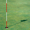
The course is a 5,924-yard, Par-70 with a slope of 115 and a rating of 68 that features rye and bent grass. Unique challenges are what you'll find at Eberhart-Petro. As a result of the course location, the St. Joseph River comes in to play not once, but FOUR times!
Regular players will describe Eberhart-Petro as being "fairly short but very tight, making shot placement key!" Shot placement is definitely key on their signature hole # 18. The tee box features a 100-yard drop that requires carrying the river!
The Eberhart-Petro Municipal Golf Course has received many updates and upgrades over the years including the installation of a new irrigation system ten years ago. The future of the course holds even more upgrades that include new drainage, tree trimming, hole layout and bunker changes.
A variety of season passes are available that include rates for everyone from juniors to seniors and corporations. Resident and non-resident passes are also available.
Eberhart-Petro boasts an average of 34,000 rounds of golf a season so, tee times are strongly recommended.
Looking for a tip or guidance to fine-tune your game? Contact the course regarding golf lessons: (574) 255-5508
Eberhart-Petro offers many amenities including a full service Bar & Grill -- perfect for relaxing and recounting your round, golf tournaments and golf leagues, the Club House Banquet Hall -- featuring a 200-person seating capacity deck that overlooks the St. Joseph River -- making it the perfect setting for wedding receptions, graduations, as well as other gatherings.
During the summer months, Eberhart-Petro participates in the City of Mishawaka "Summer Concert Series" showcasing local, regional, national, and international performance artists.
Your visit to the Eberhart-Petro Municipal Golf Course can present a challenging play, convenient location, beautiful scenery, and, if that wasn't enough, visiting Eberhart-Petro can also bring music to your ears ... literally!
The Eberhart-Petro Municipal Golf Course is also a MichianaGolf.com "Offers for Golfers" participant ... do you have your Pass yet?
To learn more, visit the Eberhart-Petro Municipal Golf Course page.
Have news to share about your course? Please contact us.
| 


 Golf Digest magazine ... the nation's most-popular golf publication and in partnership with ESPN, recently selected the Midwest's very own Michiana area as one of the best golf destinations in the world.